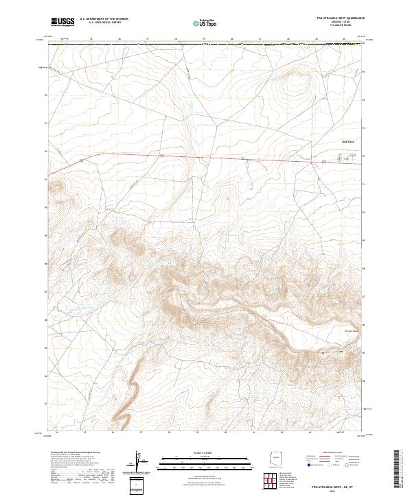
2021 Map of Toh Atin Mesa West
USGS Topo · Published 2021About this map
Red Mesa stands as the primary settlement area in this high-desert landscape of Apache County along the Arizona-Utah border. The terrain is defined by the massive uplift of Toh Atin Mesa, which dominates the southern half of the quadrangle with its complex system of canyons and ridges. Drainage networks like Willow Spring Wash and Sweetwater Wash carve through the sandstone, illustrating the erosional patterns of the Four Corners region. Transport in this part of the Navajo Nation is facilitated by a network of tribal routes, including Indian Rte 5058 and Indian Rte 5089, alongside the historic Navajo Trl. The map provides a precise look at the rural infrastructure and natural landmarks, such as Gothic Cr, that anchor this remote corner of the American Southwest.
Find a feature on this map
18 named features on this map. Tap any name to fly to it.
Don’t see what you’re looking for? This feature index may not catch every label — zoom into the map to look around manually.
Map Details
Editions of this 2021 Toh Atin Mesa West Map
This is the sole edition of this map. No revisions or reprints were ever made.
Other maps of this area

1886 · Abajo
USGS Topo · 1:250,000

1892 · Abajo
USGS Topo · 1:250,000

1892 · Canyon De Chelly
USGS Topo · 1:250,000

1893 · Abajo
USGS Topo · 1:250,000

1953 · Dinne Mesa NW
USGS Topo · 1:24,000

1953 · Dinne Mesa NE
USGS Topo · 1:24,000

1953 · Dinne Mesa SW
USGS Topo · 1:24,000

1953 · Dinne Mesa SE
USGS Topo · 1:24,000

1953 · Toh-Atin Mesa
USGS Topo · 1:62,500

1954 · Shiprock
USGS Topo · 1:250,000