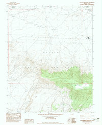
1982 Map of Toh Atin Mesa West
USGS Topo · Published 1983About this map
Navajo Indian Reservation lands dominate this high-desert landscape along the Arizona-Utah border, centered on the prominent topographic relief of Toh Atin Mesa. The area is defined by essential infrastructure for resource extraction and utility transport, including a Petroleum Underground Pipeline and a network of Drill Hole sites. These industrial elements are supported by a Road On Pipe Line and numerous Power Line Steel Towers that march across the terrain.
Find a feature on this map
21 named features on this map. Tap any name to fly to it.
Don’t see what you’re looking for? This feature index may not catch every label — zoom into the map to look around manually.
Map Details
Editions of this 1982 Toh Atin Mesa West Map
This is the sole edition of this map. No revisions or reprints were ever made.
Other maps of this area

1886 · Abajo
USGS Topo · 1:250,000

1892 · Abajo
USGS Topo · 1:250,000

1892 · Canyon De Chelly
USGS Topo · 1:250,000

1893 · Abajo
USGS Topo · 1:250,000

1953 · Dinne Mesa NW
USGS Topo · 1:24,000

1953 · Dinne Mesa NE
USGS Topo · 1:24,000

1953 · Dinne Mesa SW
USGS Topo · 1:24,000

1953 · Dinne Mesa SE
USGS Topo · 1:24,000

1953 · Toh-Atin Mesa
USGS Topo · 1:62,500

1954 · Shiprock
USGS Topo · 1:250,000