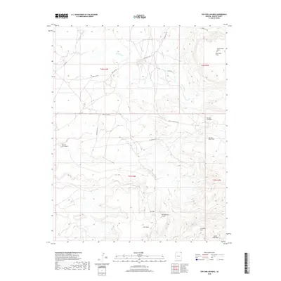
2018 Map of Toh Chin Lini Mesa
USGS Topo · Published 2018About this map
Toh Chin Lini Mesa and the surrounding high desert plateaus of Apache County define this section of the Navajo Nation. The landscape is a complex system of drainage and elevation, where seasonal watercourses like Kit Sili Wash and Tsitah Wash carve through the arid terrain. The northern reaches are dominated by Chezhindeza Mesa and the prominent Black Rock Point, while the southern portion transitions into the significant landforms of Altar Mesa and Sunnyside Mesa.
Find a feature on this map
26 named features on this map. Tap any name to fly to it.
Don’t see what you’re looking for? This feature index may not catch every label — zoom into the map to look around manually.
Map Details
Editions of this 2018 Toh Chin Lini Mesa Map
This is the sole edition of this map. No revisions or reprints were ever made.
Other maps of this area
1892 · Canyon De Chelly
USGS Topo · 1:250,000
1953 · Los Gigantes NE
USGS Topo · 1:24,000
1953 · Los Gigantes NW
USGS Topo · 1:24,000
1953 · Dinne Mesa NW
USGS Topo · 1:24,000
1953 · Pastora Peak SW
USGS Topo · 1:24,000
1953 · Pastora Peak NW
USGS Topo · 1:24,000
1953 · Dinne Mesa NE
USGS Topo · 1:24,000
1953 · Dinne Mesa SW
USGS Topo · 1:24,000
1953 · Redrock Valley NW
USGS Topo · 1:24,000
1953 · Dinne Mesa SE
USGS Topo · 1:24,000