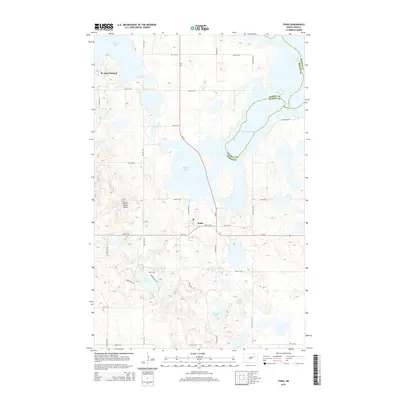
2014 Map of Tokio
USGS Topo · Published 2014About this map
Tokio and Saint Michael anchor this 2014 survey of the lakes and hills southeast of Devils Lake. The landscape is dominated by glacial depressions and water bodies, ranging from the large Black Tiger Bay to smaller features like Square Lake and Mallard Lake. A prominent geological landmark, Devils Heart Butte, rises above the surrounding terrain near the center of the sheet, providing a distinct contrast to the wetland areas of the Wood Lake Marsh Reservoir.
Find a feature on this map
32 named features on this map. Tap any name to fly to it.
Don’t see what you’re looking for? This feature index may not catch every label — zoom into the map to look around manually.
Map Details
Editions of this 2014 Tokio Map
This is the sole edition of this map. No revisions or reprints were ever made.
Other maps of this area

1928 · Tokio
USGS Topo · 1:62,500

1930 · Hamar
USGS Topo · 1:62,500

1931 · Tokio
USGS Topo · 1:62,500

1931 · Devils Lake
USGS Topo · 1:62,500
1950 · Tokio SW
USGS Topo · 1:24,000

1950 · Tokio
USGS Topo · 1:24,000

1950 · Devils Lake
USGS Topo · 1:62,500

1951 · Crary
USGS Topo · 1:24,000

1951 · Devils Lake
USGS Topo · 1:24,000

1951 · Camp Grafton
USGS Topo · 1:24,000
Featured Places
- Wood Lake District, ND
- St. Michael District, ND
- Tokio, ND
- St. Michael, St. Michael District
- Benson County, ND