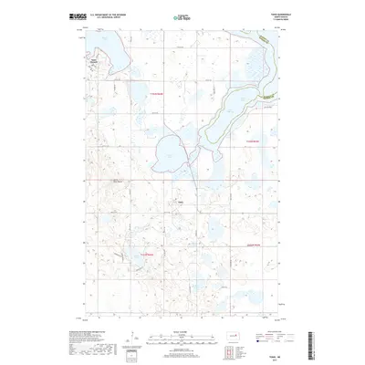
2017 Map of Tokio
USGS Topo · Published 2017About this map
Tokio and Saint Michael anchor this landscape along the southern shores of the Devils Lake basin. The area is defined by a dense concentration of glacial wetlands and water bodies, including Mission Bay, Black Tiger Bay, and Spring Lake. Moving south, the terrain rises toward Heart Butte, overlooking a cluster of smaller lakes such as Wood Lake, Square Lake, and Mallard Lake. The map reveals a systematic grid of tribal and county roads, such as BIA Rd 11 and Tribal Rd 9, which connect these small communities and rural residences. The shoreline of Devils Lake shows complex inlets and bays, illustrating the intricate hydrology of the Ramsey and Benson County border region. This 2017 survey details the contemporary residential patterns near Woodlake Hts and the established routes serving the local population.
Find a feature on this map
36 named features on this map. Tap any name to fly to it.
Don’t see what you’re looking for? This feature index may not catch every label — zoom into the map to look around manually.
Map Details
Editions of this 2017 Tokio Map
This is the sole edition of this map. No revisions or reprints were ever made.
Other maps of this area

1928 · Tokio
USGS Topo · 1:62,500

1930 · Hamar
USGS Topo · 1:62,500

1931 · Tokio
USGS Topo · 1:62,500

1931 · Devils Lake
USGS Topo · 1:62,500
1950 · Tokio SW
USGS Topo · 1:24,000

1950 · Tokio
USGS Topo · 1:24,000

1950 · Devils Lake
USGS Topo · 1:62,500

1951 · Crary
USGS Topo · 1:24,000

1951 · Devils Lake
USGS Topo · 1:24,000

1951 · Camp Grafton
USGS Topo · 1:24,000
Featured Places
- Wood Lake District, ND
- St. Michael District, ND
- Tokio, ND
- St. Michael, St. Michael District
- Benson County, ND