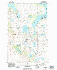
1994 Map of Tokio
USGS Topo · Published 1995About this map
The Sioux Indian Reservation dominates the southern portion of this landscape, where the settlements of Tokio and Saint Michael serve as focal points for the local community. The terrain is defined by a complex network of glacial lakes and wetlands, including Wood Lake, Graves Lake, and Mallard Lake. An Old Railroad Grade traces a path through the territory, marking the historical transportation routes that once linked these prairie outposts.
Find a feature on this map
29 named features on this map. Tap any name to fly to it.
Don’t see what you’re looking for? This feature index may not catch every label — zoom into the map to look around manually.
Map Details
Editions of this 1994 Tokio Map
This is the sole edition of this map. No revisions or reprints were ever made.
Other maps of this area

1928 · Tokio
USGS Topo · 1:62,500

1930 · Hamar
USGS Topo · 1:62,500

1931 · Tokio
USGS Topo · 1:62,500

1931 · Devils Lake
USGS Topo · 1:62,500
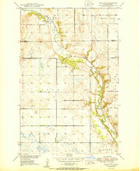
1950 · Tokio SW
USGS Topo · 1:24,000

1950 · Tokio
USGS Topo · 1:24,000

1950 · Devils Lake
USGS Topo · 1:62,500

1951 · Crary
USGS Topo · 1:24,000

1951 · Devils Lake
USGS Topo · 1:24,000

1951 · Camp Grafton
USGS Topo · 1:24,000
Featured Places
- Wood Lake District, ND
- St. Michael District, ND
- St. Michael, St. Michael District
- Tokio, ND
- Ramsey County, ND