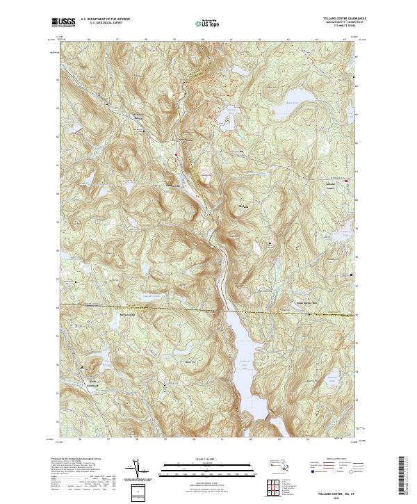
2024 Map of Tolland Center
USGS Topo · Published 2024About this map
West New Boston and New Boston sit at the northern edge of this landscape where the Buck River meets the Clam River, marking a territory defined by narrow valleys and high ridges. The map illustrates the interstate boundary between Massachusetts and Connecticut, a divide that separates the small communities of McClaveville and North Colebrook from the more developed Tolland Center to the northeast. The southern half is dominated by the expansive Colebrook River Lake, which fills the valley floor once carved by the West Branch Farmington River. Genealogists will find a high density of small family and local burial sites, including the Babcock Family Cem and Baptist Cem. Terrain features like Snow Mtn and Mt Prospect overlook a network of backcountry roads such as Roosterville Rd and Old Colebrook Rd, which follow the ancient contours of the hills.
Find a feature on this map
121 named features on this map. Tap any name to fly to it.
Don’t see what you’re looking for? This feature index may not catch every label — zoom into the map to look around manually.
Map Details
Editions of this 2024 Tolland Center Map
This is the sole edition of this map. No revisions or reprints were ever made.
Other maps of this area

1887 · Granville
USGS Topo · 1:62,500

1888 · Sandisfield
USGS Topo · 1:62,500

1889 · Granville
USGS Topo · 1:62,500

1892 · Winsted
USGS Topo · 1:62,500

1892 · Granby
USGS Topo · 1:62,500

1893 · Granville
USGS Topo · 1:62,500

1893 · Sandisfield
USGS Topo · 1:62,500

1895 · Granville
USGS Topo · 1:62,500

1896 · Holyoke
USGS Topo · 1:125,000

1897 · Sandisfield
USGS Topo · 1:62,500