2021 Map of Tolstoy
USGS Topo · Published 2021About this map
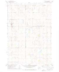
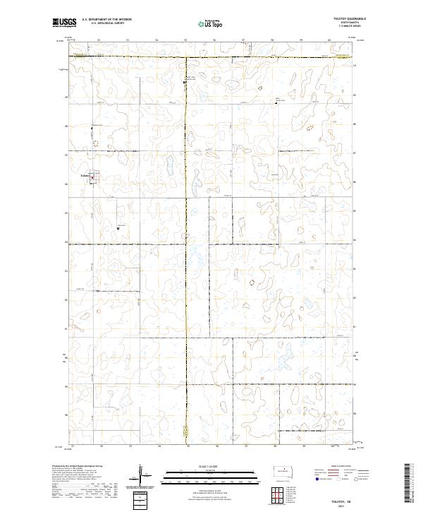
Tolstoy serves as the central settlement in this portion of the Potter County prairie, situated along the intersection of Main St and 327th Ave. The landscape is defined by the high density of prairie potholes and small wetlands that pattern the township lines of T120N R73W and T120N R72W. This grid of section roads, including 148th St and 151st St, organizes a rural landscape where community life is anchored by several denominational burial grounds. These include the Lutheran Cem, Zion Cem, Saint Jacobs Cem, and the Seventh - Day Adventist Cem, reflecting the diverse religious heritage of the area's early homesteaders. The map also captures the tri-county meeting point of Potter, Edmunds, and Faulk counties, illustrating the political boundaries that intersect this agricultural region.
Find a feature on this map
32 named features on this map. Tap any name to fly to it.
Don’t see what you’re looking for? This feature index may not catch every label — zoom into the map to look around manually.
Map Details
Editions of this 2021 Tolstoy Map
This is the sole edition of this map. No revisions or reprints were ever made.