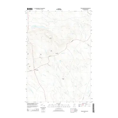
2014 Map of Tomah Mountain
USGS Topo · Published 2014About this map
Codyville and the town of Topsfield anchor this portion of Washington County, where the landscape is defined by a dense network of waterways feeding into Tomah Stream. The area's topography is notably varied, rising from the wetlands around Unknown Pond and Simon Pond to the prominent heights of Tomah Mountain and The High Bluffs. This 2014 survey illustrates a rural Maine interior where modern roads like Us-1 and Vanceboro Rd follow long-established corridors through the timberlands. Local landmarks such as Kane Ridge, Hunt Ridge, and Loring Hill divide the drainage basins of numerous small brooks, including Jim Brown Brook and Barter Brook. The map provides a clear look at the spatial relationship between isolated settlements and the extensive water system of Little Tomah Lake and its associated streams, reflecting the enduring geography of the Maine woods.
Find a feature on this map
36 named features on this map. Tap any name to fly to it.
Don’t see what you’re looking for? This feature index may not catch every label — zoom into the map to look around manually.
Map Details
Editions of this 2014 Tomah Mountain Map
This is the sole edition of this map. No revisions or reprints were ever made.
Other maps of this area

1940 · Danforth
USGS Topo · 1:62,500

1940 · Waite
USGS Topo · 1:62,500

1940 · Forest
USGS Topo · 1:62,500

1941 · Danforth
USGS Topo · 1:62,500

1941 · Scraggly Lake
USGS Topo · 1:62,500

1942 · Waite
USGS Topo · 1:62,500

1942 · Forest
USGS Topo · 1:62,500

1943 · Danforth
USGS Topo · 1:62,500

1944 · Scraggly Lake
USGS Topo · 1:62,500

1957 · Fredericton
USGS Topo · 1:250,000