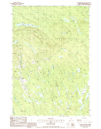
1988 Map of Tomah Mountain
USGS Topo · Published 1988About this map
Tomah Mountain rises above a complex drainage system in eastern Maine, where the townships of Topsfield, Codyville Plt, Talmadge, and Waite converge. The landscape is defined by its glacial heritage, featuring expansive wetlands like Malcome Bog and Lathrop Heath, alongside numerous water bodies including Little Tomah Lake and Simon Pond. The settlement at Topsfield is a primary focal point, showing local infrastructure such as a Cem, Sub Station, and a Microwave Tower.
Find a feature on this map
37 named features on this map. Tap any name to fly to it.
Don’t see what you’re looking for? This feature index may not catch every label — zoom into the map to look around manually.
Map Details
Editions of this 1988 Tomah Mountain Map
This is the sole edition of this map. No revisions or reprints were ever made.
Other maps of this area

1940 · Danforth
USGS Topo · 1:62,500

1940 · Waite
USGS Topo · 1:62,500

1940 · Forest
USGS Topo · 1:62,500

1941 · Danforth
USGS Topo · 1:62,500

1941 · Scraggly Lake
USGS Topo · 1:62,500

1942 · Waite
USGS Topo · 1:62,500

1942 · Forest
USGS Topo · 1:62,500

1943 · Danforth
USGS Topo · 1:62,500

1944 · Scraggly Lake
USGS Topo · 1:62,500

1957 · Fredericton
USGS Topo · 1:250,000