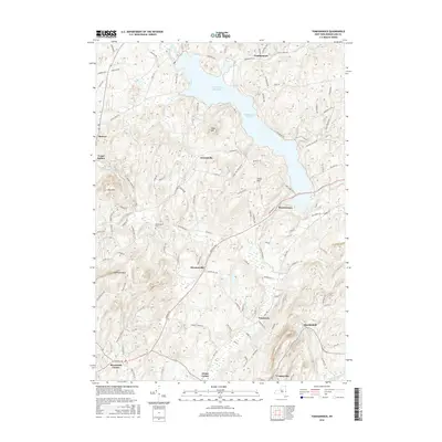
2016 Map of Tomhannock
USGS Topo · Published 2016About this map
The Tomhannock Reservoir dominates the northern half of this landscape, its irregular shoreline reaching toward settlements like Tomhannock and Raymertown. This mid-2010s topographic survey illustrates the transition from the rolling terrain around Piser Hill to the more prominent elevations of Mt Rafinesque and Rice Mtn in the west. A network of local roads such as Northern Tpke and Hoosick Rd connects established rural communities including Haynersville, Lincolnville, and Brunswick Center.
Find a feature on this map
109 named features on this map. Tap any name to fly to it.
Don’t see what you’re looking for? This feature index may not catch every label — zoom into the map to look around manually.
Map Details
Editions of this 2016 Tomhannock Map
This is the sole edition of this map. No revisions or reprints were ever made.
Other maps of this area

1888 · Berlin
USGS Topo · 1:62,500

1890 · Berlin
USGS Topo · 1:62,500

1893 · Cohoes
USGS Topo · 1:62,500

1893 · Troy
USGS Topo · 1:62,500

1894 · Berlin
USGS Topo · 1:62,500

1895 · Troy
USGS Topo · 1:62,500

1895 · Cohoes
USGS Topo · 1:62,500

1897 · Hoosick
USGS Topo · 1:62,500

1898 · Berlin
USGS Topo · 1:62,500

1898 · Cohoes
USGS Topo · 1:62,500