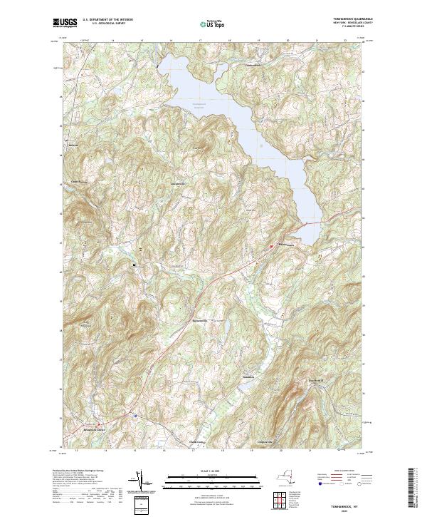
2023 Map of Tomhannock
USGS Topo · Published 2023About this map
The Tomhannock Reservoir dominates the northern landscape of this region, its sprawling waters fed by Tomhannock Creek and Otter Creek. The area is defined by a series of high points like Rice Mountain and Mount Rafinesque, which overlook a network of valley settlements. This modern view reveals the proximity of rural hamlets including Raymertown and Lincolnville to the major reservoir infrastructure. Genealogists can locate Maplewood Cem situated near the headwaters of Deep Kill. The map illustrates the persistent settlement patterns of Rensselaer County, where old roadways like the Northern Tpke connect established centers such as Brunswick Center and Cropseyville amidst the varied elevations of Piser Hill and Fords Hill.
Find a feature on this map
114 named features on this map. Tap any name to fly to it.
Don’t see what you’re looking for? This feature index may not catch every label — zoom into the map to look around manually.
Map Details
Editions of this 2023 Tomhannock Map
This is the sole edition of this map. No revisions or reprints were ever made.
Other maps of this area

1888 · Berlin
USGS Topo · 1:62,500

1890 · Berlin
USGS Topo · 1:62,500

1893 · Cohoes
USGS Topo · 1:62,500

1893 · Troy
USGS Topo · 1:62,500

1894 · Berlin
USGS Topo · 1:62,500

1895 · Troy
USGS Topo · 1:62,500

1895 · Cohoes
USGS Topo · 1:62,500

1897 · Hoosick
USGS Topo · 1:62,500

1898 · Berlin
USGS Topo · 1:62,500

1898 · Cohoes
USGS Topo · 1:62,500