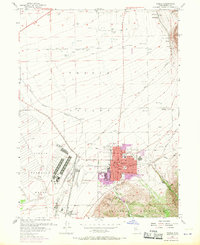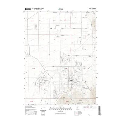
1997 Map of Tooele
USGS Topo · Published 2002About this map
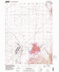
Tooele and the surrounding Tooele Valley are documented in this era of transition from rural high desert to an industrial and suburban hub. The massive footprint of the Tooele Army Depot occupies the southwest, while the municipal center shows a dense grid featuring the Court House, City Hall, and local schools such as Sterling Harris Sch and Central Sch. This landscape is defined by its water management and extraction history, with numerous Artesian Wells, Reservoir sites, and extensive Gravel Pits dotting the valley floor.
Find a feature on this map
50 named features on this map. Tap any name to fly to it.
Don’t see what you’re looking for? This feature index may not catch every label — zoom into the map to look around manually.
Map Details
Editions of this 1997 Tooele Map
This is the sole edition of this map. No revisions or reprints were ever made.
Historical Maps of Tooele Through Time
10 maps found