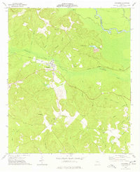
1973 Map of Toomsboro
USGS Topo · Published 1977About this map
Toomsboro serves as the focal point of this 1970s landscape, positioned at the intersection of local roads and the Central of Georgia railroad. The settlement is defined by its proximity to Commissioner Creek and a network of named branches, reflecting a rural Georgia economy transition between traditional agriculture and industrial extraction, evidenced by a nearby Claypit. This period of Wilkinson County history is well-documented through numerous family and congregational landmarks, including Ebenezer Church and the Union Hill Church.
Find a feature on this map
34 named features on this map. Tap any name to fly to it.
Don’t see what you’re looking for? This feature index may not catch every label — zoom into the map to look around manually.
Map Details
Editions of this 1973 Toomsboro Map
This is the sole edition of this map. No revisions or reprints were ever made.
Other maps of this area

1916 · Irwinton
USGS Topo · 1:62,500

1920 · Irwinton
USGS Topo · 1:62,500

1957 · Macon
USGS Topo · 1:250,000

1958 · Macon
USGS Topo · 1:250,000

1962 · Oconee
USGS Topo · 1:24,000

1962 · Tabernacle
USGS Topo · 1:24,000

1964 · Macon
USGS Topo · 1:250,000
1973 · Napier Pond
USGS Topo · 1:24,000
1973 · Irwinton
USGS Topo · 1:24,000
1973 · Gumm Pond
USGS Topo · 1:24,000