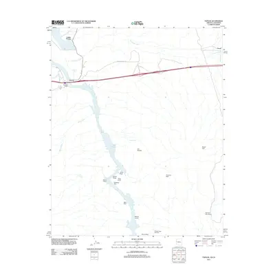
2011 Map of Topock
USGS Topo · Published 2011About this map
Topock sits at a critical crossing of the Colorado River, where transportation infrastructure meets the dramatic geology of the Arizona-California border. This survey details the river's transition through the Topock Gorge, a stretch defined by striking landmarks such as The Needles, Devils Elbow, and Cathedral Rock. To the north, the settlement of Catfish Paradise occupies a position near Topock Bay, while the landscape to the east rises into the Mohave Mountains. The map tracks the drainage patterns of the Sacramento Wash and Mohave Wash as they feed toward the southern extent of the river valley, which eventually opens into Lake Havasu. Local landmarks like the Red Rock Bridge and the Picture Rock Window provide specific points of reference for researchers interested in the historical development of this desert corridor.
Find a feature on this map
27 named features on this map. Tap any name to fly to it.
Don’t see what you’re looking for? This feature index may not catch every label — zoom into the map to look around manually.
Map Details
Editions of this 2011 Topock Map
This is the sole edition of this map. No revisions or reprints were ever made.
Other maps of this area

1903 · Needles
USGS Topo · 1:125,000

1904 · Needles Special
USGS Topo · 1:125,000

1943 · Topock
USGS Topo · 1:62,500

1950 · Topock
USGS Topo · 1:62,500

1950 · Sawtooth Range
USGS Topo · 1:62,500

1950 · Needles
USGS Topo · 1:62,500

1951 · Topock
USGS Topo · 1:62,500

1951 · Sawtooth Range
USGS Topo · 1:62,500

1952 · Needles
USGS Topo · 1:62,500

1954 · Needles
USGS Topo · 1:250,000