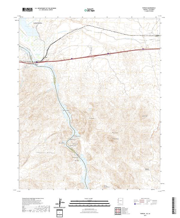
2021 Map of Topock
USGS Topo · Published 2021About this map
The Colorado River carves a path through the arid borderlands of Arizona and California, defining the landscape where the Mohave Valley meets the Chemehuevi Mountains. At the heart of this region is Topock, a critical transportation node where Hist Rte 66 and interstate travel corridors converge near the Red Rock Bridge. The river's influence is evident in the transition from the open waters of Topock Bay and the wetlands of Topock Marsh to the narrow, high-walled confines of Topock Gorge. This 2021 survey details the rugged topography surrounding Mohave Canyon and Devils Elbow, where named formations like The Needles and Cathedral Rock rise above the water. These desert reaches are further defined by expansive drainage systems such as Sacramento Wash and Mohave Wash, which cut through the Mojave Desert toward the river's edge, creating a complex network of canyons and peaks.
Find a feature on this map
45 named features on this map. Tap any name to fly to it.
Don’t see what you’re looking for? This feature index may not catch every label — zoom into the map to look around manually.
Map Details
Editions of this 2021 Topock Map
This is the sole edition of this map. No revisions or reprints were ever made.
Other maps of this area

1903 · Needles
USGS Topo · 1:125,000

1904 · Needles Special
USGS Topo · 1:125,000

1943 · Topock
USGS Topo · 1:62,500

1950 · Topock
USGS Topo · 1:62,500

1950 · Sawtooth Range
USGS Topo · 1:62,500

1950 · Needles
USGS Topo · 1:62,500

1951 · Topock
USGS Topo · 1:62,500

1951 · Sawtooth Range
USGS Topo · 1:62,500

1952 · Needles
USGS Topo · 1:62,500

1954 · Needles
USGS Topo · 1:250,000