2024 Map of Tower City
USGS Topo · Published 2024About this map
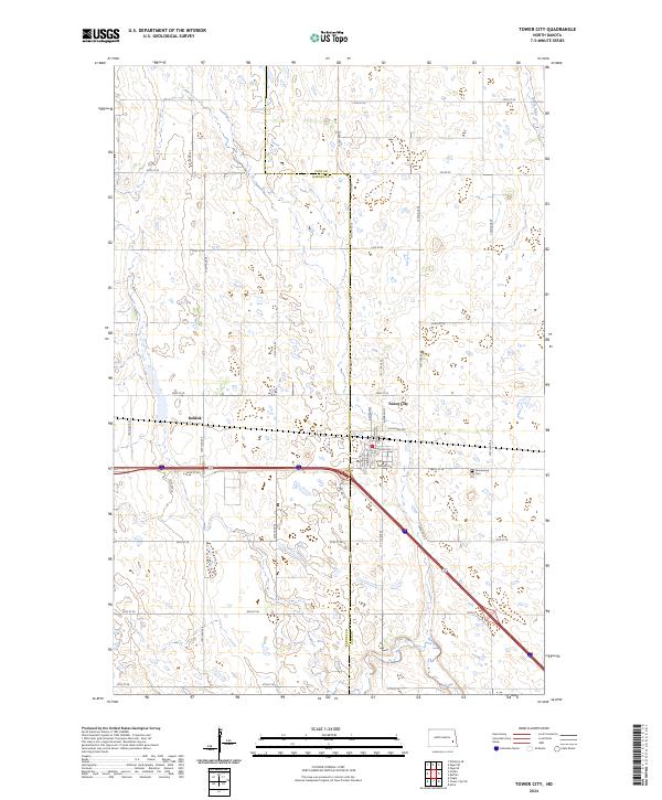
Tower City serves as the primary focal point of this Eastern North Dakota landscape, situated along the boundary where Barnes and Cass Counties meet. The town's grid is well-defined by a residential network including Maine St, Church St, and Elizabeth St, while the surrounding prairie is marked by the distinct sectional divisions of the Public Land Survey System. To the west, the locality of Koldok appears along the rail corridor, while the Greenwood Cemetery sits just east of the main settlement. The Maple River meanders through the northeastern corner, providing a natural contrast to the rigid geometry of the agricultural landscape. This survey documents the contemporary infrastructure of the region, from the primary thoroughfare of Michigan Ave to the numerous section-line roads like 34th St SE that facilitate the local farming economy.
Find a feature on this map
32 named features on this map. Tap any name to fly to it.
Don’t see what you’re looking for? This feature index may not catch every label — zoom into the map to look around manually.
Map Details
Editions of this 2024 Tower City Map
This is the sole edition of this map. No revisions or reprints were ever made.