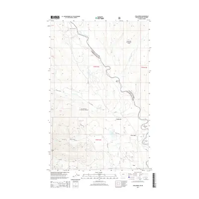
2014 Map of Trailcreek
USGS Topo · Published 2014About this map
The North Fork Flathead River carves a path through this borderland region where the Glacier National Park boundary meets the Flathead National Forest. This geography is defined by its water and high-altitude relief, featuring Tepee Lake, Miller Lake, and Garnet Lake set against prominent landmarks like Wedge Mtn and Wurtz Hill. The settlement at Trailcreek and the isolated Moose City Airport suggest a landscape where transportation is dictated by the river valley and primitive road networks such as Trail Creek Rd and N Fork Rd. Remote outposts like Ford and the geologic transition at Abbotts Flats provide evidence of early 21st-century land use in a region characterized by massive federal land holdings and preserved wilderness.
Find a feature on this map
38 named features on this map. Tap any name to fly to it.
Don’t see what you’re looking for? This feature index may not catch every label — zoom into the map to look around manually.
Map Details
Editions of this 2014 Trailcreek Map
This is the sole edition of this map. No revisions or reprints were ever made.
Other maps of this area

1906 · Kintla Lakes
USGS Topo · 1:125,000

1913 · Stryker
USGS Topo · 1:125,000

1916 · Stryker
USGS Topo · 1:125,000

1938 · Kintla Lakes
USGS Topo · 1:125,000

1957 · Kalispell
USGS Topo · 1:250,000

1960 · Kalispell
USGS Topo · 1:250,000

1961 · Kalispell
USGS Topo · 1:250,000

1966 · Red Meadow Lake
USGS Topo · 1:24,000

1966 · Kintla Lake
USGS Topo · 1:24,000

1966 · Mount Hefty
USGS Topo · 1:24,000