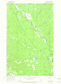
1966 Map of Trailcreek
USGS Topo · Published 1971About this map
The Canada-United States border forms the northern limit of this mid-1960s survey, where the Flathead River (North Fork) carves a meandering path between Glacier National Park and the Flathead National Forest. This remote stretch of Flathead County is characterized by isolated outposts and high-elevation terrain, featuring the Kishenehn Patrol Cabin and the small settlement of Trailcreek.
Find a feature on this map
30 named features on this map. Tap any name to fly to it.
Don’t see what you’re looking for? This feature index may not catch every label — zoom into the map to look around manually.
Map Details
Editions of this 1966 Trailcreek Map
This is the sole edition of this map. No revisions or reprints were ever made.
Other maps of this area

1906 · Kintla Lakes
USGS Topo · 1:125,000

1913 · Stryker
USGS Topo · 1:125,000

1916 · Stryker
USGS Topo · 1:125,000

1938 · Kintla Lakes
USGS Topo · 1:125,000

1957 · Kalispell
USGS Topo · 1:250,000

1960 · Kalispell
USGS Topo · 1:250,000

1961 · Kalispell
USGS Topo · 1:250,000

1966 · Red Meadow Lake
USGS Topo · 1:24,000

1966 · Kintla Lake
USGS Topo · 1:24,000

1966 · Mount Hefty
USGS Topo · 1:24,000