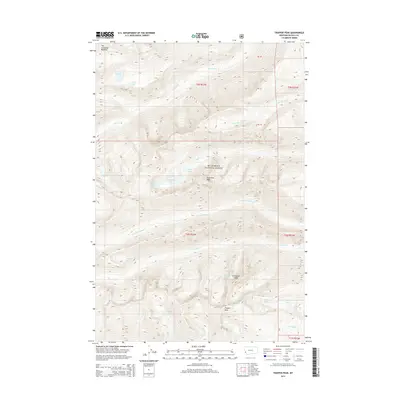
2014 Map of Trapper Peak
USGS Topo · Published 2014About this map
Trapper Peak and its surrounding high-altitude drainage basins dominate this 2014 survey of the central Bitterroot National Forest. The landscape is defined by its glacial cirques and alpine lakes, including Trapper Lake, Chaffin Lake, and Baker Lake, which feed a complex network of eastward-flowing streams like Tin Cup Cr and Chaffin Cr. Unique landmarks such as The Lonesome Bachelor and Sugarloaf Peak illustrate the complex topography of the Bitterroot Range. The map details the transition from high ridgelines to the headwaters of numerous creeks, such as N Fork Trapper Cr and Crow Cr, showing the hydrological patterns that have historically shaped this part of Ravalli County. This modern topographic study reveals the preserved state of the wilderness, where names like Tamarack Lake and Mink Lake recall the area's natural heritage.
Find a feature on this map
30 named features on this map. Tap any name to fly to it.
Don’t see what you’re looking for? This feature index may not catch every label — zoom into the map to look around manually.
Map Details
Editions of this 2014 Trapper Peak Map
This is the sole edition of this map. No revisions or reprints were ever made.
Other maps of this area

1901 · Hamilton
USGS Topo · 1:125,000

1956 · Elk City
USGS Topo · 1:250,000

1956 · Hamilton
USGS Topo · 1:250,000

1959 · Hamilton
USGS Topo · 1:250,000

1960 · Elk City
USGS Topo · 1:250,000

1960 · Hamilton
USGS Topo · 1:250,000

1964 · Hamilton
USGS Topo · 1:250,000

1964 · Burnt Ridge
USGS Topo · 1:24,000

1964 · Boulder Peak
USGS Topo · 1:24,000

1964 · Darby
USGS Topo · 1:24,000