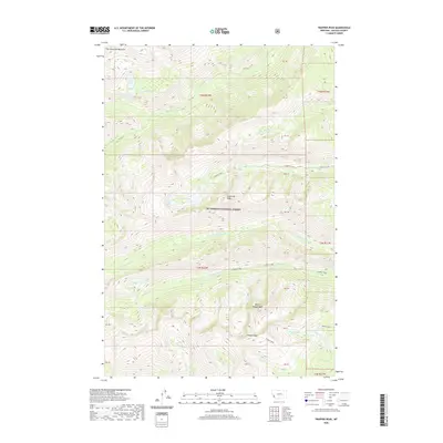
2020 Map of Trapper Peak
USGS Topo · Published 2020About this map
Trapper Peak and its companion summit, North Trapper Peak, anchor this high-elevation terrain within the Bitterroot National Forest. The landscape is defined by a dense concentration of glacial cirque lakes and alpine drainage systems. Significant water bodies like Baker Lake, Trapper Lake, and Mink Lake are tucked into the steep drainages of Trapper Creek and Mink Cr. To the north, distinctive landmarks such as The Lonesome Bachelor and Sugarloaf Peak overlook the headwaters of Tin Cup Cr and Chaffin Creek. This 2020 survey provides a modern view of the complex hydrography and summit topography of the Bitterroot Range, detailing the myriad small streams like Slide Cr and Crow Cr that feed the larger valley systems.
Find a feature on this map
41 named features on this map. Tap any name to fly to it.
Don’t see what you’re looking for? This feature index may not catch every label — zoom into the map to look around manually.
Map Details
Editions of this 2020 Trapper Peak Map
This is the sole edition of this map. No revisions or reprints were ever made.
Other maps of this area

1901 · Hamilton
USGS Topo · 1:125,000

1956 · Elk City
USGS Topo · 1:250,000

1956 · Hamilton
USGS Topo · 1:250,000

1959 · Hamilton
USGS Topo · 1:250,000

1960 · Elk City
USGS Topo · 1:250,000

1960 · Hamilton
USGS Topo · 1:250,000

1964 · Hamilton
USGS Topo · 1:250,000

1964 · Burnt Ridge
USGS Topo · 1:24,000

1964 · Boulder Peak
USGS Topo · 1:24,000

1964 · Darby
USGS Topo · 1:24,000