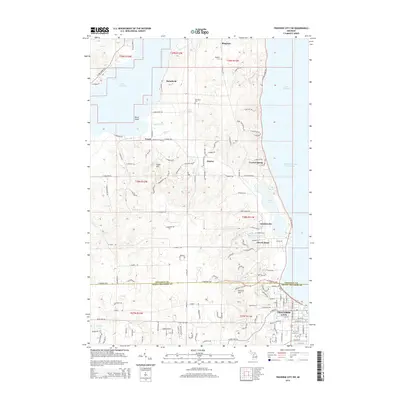
2014 Map of Traverse City SW
USGS Topo · Published 2014About this map
The West Arm Grand Traverse Bay and the shoreline of Lake Leelanau define this portion of the Leelanau Peninsula. In the early 21st century, the landscape shows a dense network of residential roads and small settlements like Greilickville and Cherry Bend tucked between the water and the rising terrain of Hickory Hill. The boundary between Leelanau Co and Grand Traverse Co runs through the southern portion of the map, where the northwestern outskirts of Traverse City begin to give way to more rural township land. Local history is anchored by small burial grounds such as Bingham Cem, Heimforth Cem, and Fouch Cem. The geography is shaped by water, from the Boardman River and Kids Cr in the south to Cedar Lake and Cherry Bend Lake further north, illustrating the region's character as a lake-front residential and recreational hub.
Find a feature on this map
142 named features on this map. Tap any name to fly to it.
Don’t see what you’re looking for? This feature index may not catch every label — zoom into the map to look around manually.
Map Details
Editions of this 2014 Traverse City SW Map
This is the sole edition of this map. No revisions or reprints were ever made.
Other maps of this area

1954 · Traverse City
USGS Topo · 1:250,000

1956 · Kingsley
USGS Topo · 1:62,500

1956 · Thompsonville
USGS Topo · 1:62,500

1957 · Traverse City
USGS Topo · 1:62,500

1957 · Maple City
USGS Topo · 1:62,500

1958 · Traverse City
USGS Topo · 1:250,000

1976 · Thompsonville NE
USGS Topo · 1:24,000

1983 · Maple City
USGS Topo · 1:24,000

1983 · Traverse City SE
USGS Topo · 1:25,000

1983 · Traverse City
USGS Topo · 1:100,000
Featured Places
- Garfield Township, MI
- Traverse City, MI
- Long Lake Township, MI
- Elmwood Charter Township, MI
- Greilickville, Elmwood Charter Township