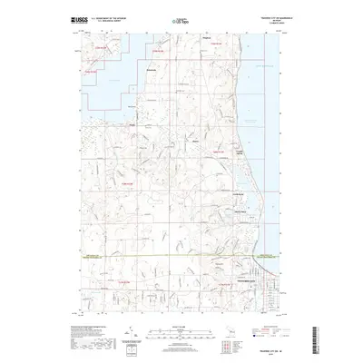
2019 Map of Traverse City SW
USGS Topo · Published 2019About this map
Lake Michigan and the West Arm Grand Traverse Bay define the eastern edge of this Leelanau and Grand Traverse County landscape. Residential development and recreational geography are evident in the density of modern road networks like S West Bay Shore Dr and E Cherry Bend Rd which link the shorelines of Lake Leelanau and Cedar Lake. Historically significant sites for genealogists include the Bingham Cem, Heimforth Cem, and Fouch Cem, which anchor the small established communities of Bingham, Heimforth, and Fouch.
Find a feature on this map
154 named features on this map. Tap any name to fly to it.
Don’t see what you’re looking for? This feature index may not catch every label — zoom into the map to look around manually.
Map Details
Editions of this 2019 Traverse City SW Map
This is the sole edition of this map. No revisions or reprints were ever made.
Other maps of this area

1954 · Traverse City
USGS Topo · 1:250,000

1956 · Kingsley
USGS Topo · 1:62,500

1956 · Thompsonville
USGS Topo · 1:62,500

1957 · Traverse City
USGS Topo · 1:62,500

1957 · Maple City
USGS Topo · 1:62,500

1958 · Traverse City
USGS Topo · 1:250,000

1976 · Thompsonville NE
USGS Topo · 1:24,000

1983 · Maple City
USGS Topo · 1:24,000

1983 · Traverse City SE
USGS Topo · 1:25,000

1983 · Traverse City
USGS Topo · 1:100,000
Featured Places
- Garfield Township, MI
- Traverse City, MI
- Long Lake Township, MI
- Elmwood Charter Township, MI
- Greilickville, Elmwood Charter Township