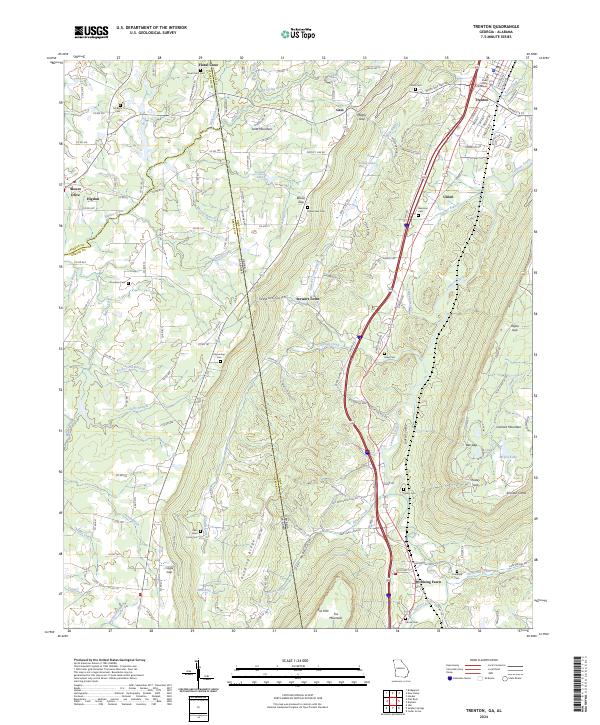
2024 Map of Trenton
USGS Topo · Published 2024About this map
Trenton serves as the focal point of this Northwest Georgia survey, situated in the valley between the prominent elevations of Lookout Mountain and Sand Mountain. The landscape is defined by its dramatic relief, where deep ravines like Deer Head Cove and Johnson Crook break the plateau edges, and water flows through drainage systems including Lookout Creek and Crawfish Creek. The mapping reveals a rural infrastructure of high genealogical value, noting numerous family-named landmarks and resting places such as Newman Cem, Easley Cem, and Hanna Cem. The Dade County Courthouse stands at the center of the regional seat, while smaller settlements like Rising Fawn and Stewart Town are connected by a network of valley roads and mountain gaps. The distribution of these communities reflects the constraints of the terrain, with agricultural activity concentrated along the narrow valley floors and the level tops of the surrounding ridges like Pudding Ridge.
Find a feature on this map
67 named features on this map. Tap any name to fly to it.
Don’t see what you’re looking for? This feature index may not catch every label — zoom into the map to look around manually.
Map Details
Editions of this 2024 Trenton Map
This is the sole edition of this map. No revisions or reprints were ever made.
Historical Maps of Eliza Through Time
4 maps found