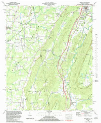
1982 Map of Trenton
USGS Topo · Published 1984About this map
Lookout Valley and the surrounding plateaus are captured here in the early 1980s, documenting a landscape defined by dramatic topography and rural settlement. The Alabama Great Southern railroad corridor serves as the primary artery through the valley, connecting the town of Trenton to the southern community of Rising Fawn. This survey illustrates the distinct geological transition from the broad expanse of Sand Mountain in the west to the sharp ridgeline of Lookout Mountain in the east, separated by Back Valley and the Pudding Ridge formations.
Find a feature on this map
84 named features on this map. Tap any name to fly to it.
Don’t see what you’re looking for? This feature index may not catch every label — zoom into the map to look around manually.
Map Details
Editions of this 1982 Trenton Map
This is the sole edition of this map. No revisions or reprints were ever made.
Other maps of this area

1886 · Ringgold
USGS Topo · 1:125,000

1886 · Stevenson
USGS Topo · 1:125,000

1892 · Ringgold
USGS Topo · 1:125,000

1892 · Stevenson
USGS Topo · 1:125,000

1895 · Stevenson
USGS Topo · 1:125,000

1935 · Durham
USGS Topo · 1:24,000

1936 · Trenton
USGS Topo · 1:24,000

1936 · Ider
USGS Topo · 1:24,000

1936 · Shellmound
USGS Topo · 1:24,000

1936 · Bridgeport
USGS Topo · 1:24,000