
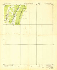
1936 Map of Ider
USGS Topo · Published 1936About this map
Yorks Mill and a series of rural crossroads define this landscape along the plateau of northeast Alabama in the mid-1930s. The settlement pattern is characterized by community hubs such as Ider, Beaty Crossroads, and Poplar Springs Crossroads, which served as central points for the surrounding farmsteads. Public life is anchored by numerous country churches and schools, including New Bethel Ch No 2, Macedonia Ch, and the Shrader Sch.
Find a feature on this map
53 named features on this map. Tap any name to fly to it.
Don’t see what you’re looking for? This feature index may not catch every label — zoom into the map to look around manually.
Map Details
Editions of this 1936 Ider Map
This is the sole edition of this map. No revisions or reprints were ever made.
Other maps of this area

1886 · Stevenson
USGS Topo · 1:125,000

1892 · Stevenson
USGS Topo · 1:125,000

1895 · Stevenson
USGS Topo · 1:125,000

1936 · Trenton
USGS Topo · 1:24,000

1936 · Flat Rock
USGS Topo · 1:24,000

1936 · Dugout Valley
USGS Topo · 1:24,000

1936 · Sulphur Springs
USGS Topo · 1:24,000

1936 · Sylvania
USGS Topo · 1:24,000

1936 · Stevenson
USGS Topo · 1:24,000
1936 · Little Falls
USGS Topo · 1:24,000