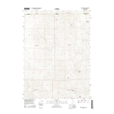
2015 Map of Trident Peak
USGS Topo · Published 2015About this map
Trident Peak stands as a prominent high point in this high-desert landscape situated along the border where Oregon meets Nevada. This remote section of Humboldt County is defined by the significant elevations of the Bilk Creek Mountains and the Trout Creek Mountains, punctuated by landmarks such as Granite Mtn and Black Diamond Peak. The drainage patterns here are critical for navigating the arid terrain, with Maggie Cr and Little Wilder Cr carving paths through the high plateaus. The presence of numerous isolated water sources, including Crow Creek Spring, Buster Springs, and Rock Spring, indicates the vital importance of these points for both local wildlife and any historically documented ranching activity in the region. Transportation is limited to rugged tracks like Wilder Rd, which skirts the edge of the Dry Canyon and allows access through the complex topography of Long Canyon and House Creek Butte.
Find a feature on this map
36 named features on this map. Tap any name to fly to it.
Don’t see what you’re looking for? This feature index may not catch every label — zoom into the map to look around manually.
Map Details
Editions of this 2015 Trident Peak Map
This is the sole edition of this map. No revisions or reprints were ever made.
Other maps of this area

1886 · Disaster
USGS Topo · 1:250,000

1893 · Disaster
USGS Topo · 1:250,000

1954 · Vya
USGS Topo · 1:250,000

1955 · Adel
USGS Topo · 1:250,000

1957 · Adel
USGS Topo · 1:250,000

1958 · Vya
USGS Topo · 1:250,000

1958 · Adel
USGS Topo · 1:250,000

1961 · Trident Peak
USGS Topo · 1:62,500

1962 · Vya
USGS Topo · 1:250,000

1962 · Adel
USGS Topo · 1:250,000