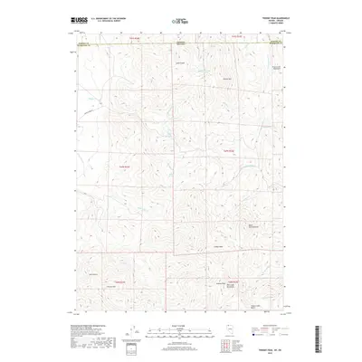
2018 Map of Trident Peak
USGS Topo · Published 2018About this map
Trident Peak stands as a central landmark in this high-desert landscape where the border between Nevada and Oregon follows a survey line across the Trout Creek Mountains. The area is defined by sharp elevation changes and essential water sources, with names like Crow Creek Spring, Maggie Creek Spring, and Buster Springs marking the vital points for ranching and wildlife in an otherwise arid environment. Evidence of a rugged road network appears via Wilder Creek Rd, which tracks through the western canyons near Little Wilder Cr. The southern portion of the quadrangle is dominated by the Bilk Creek Mountains, where Engeler Peak and Granite Mtn rise above the drainage of Bilk Cr. This 2018 survey provides a clear view of the complex topography used by those navigating the remote borderlands of Humboldt County and Harney County.
Find a feature on this map
36 named features on this map. Tap any name to fly to it.
Don’t see what you’re looking for? This feature index may not catch every label — zoom into the map to look around manually.
Map Details
Editions of this 2018 Trident Peak Map
This is the sole edition of this map. No revisions or reprints were ever made.
Other maps of this area

1886 · Disaster
USGS Topo · 1:250,000

1893 · Disaster
USGS Topo · 1:250,000

1954 · Vya
USGS Topo · 1:250,000

1955 · Adel
USGS Topo · 1:250,000

1957 · Adel
USGS Topo · 1:250,000

1958 · Vya
USGS Topo · 1:250,000

1958 · Adel
USGS Topo · 1:250,000

1961 · Trident Peak
USGS Topo · 1:62,500

1962 · Vya
USGS Topo · 1:250,000

1962 · Adel
USGS Topo · 1:250,000