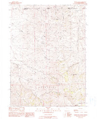
1990 Map of Trident Peak
USGS Topo · Published 1990About this map
The Bilk Creek Mountains dominate this 1990 survey, straddling the remote high-desert border where Humboldt Co, Nevada, meets Harney Co, Oregon. This landscape is defined by its high summits and scattered water sources, including Trident Peak and Black Diamond Peak. The area's human history is marked by small-scale mining operations and isolated dwellings, evidenced by the Lucky Strike Mine and Catlow Mine on the eastern slopes.
Find a feature on this map
37 named features on this map. Tap any name to fly to it.
Don’t see what you’re looking for? This feature index may not catch every label — zoom into the map to look around manually.
Map Details
Editions of this 1990 Trident Peak Map
This is the sole edition of this map. No revisions or reprints were ever made.
Other maps of this area

1886 · Disaster
USGS Topo · 1:250,000

1893 · Disaster
USGS Topo · 1:250,000

1954 · Vya
USGS Topo · 1:250,000

1955 · Adel
USGS Topo · 1:250,000

1957 · Adel
USGS Topo · 1:250,000

1958 · Vya
USGS Topo · 1:250,000

1958 · Adel
USGS Topo · 1:250,000

1961 · Trident Peak
USGS Topo · 1:62,500

1962 · Vya
USGS Topo · 1:250,000

1962 · Adel
USGS Topo · 1:250,000