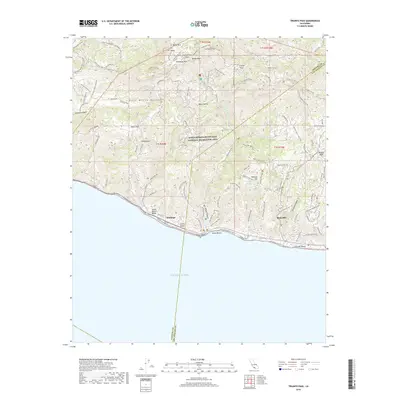
2018 Map of Triunfo Pass
USGS Topo · Published 2018About this map
The Santa Monica Mountains National Recreation Area dominates this coastal landscape, where the high peaks of the Santa Monica Mountains meet the Pacific Ocean. This 2018 survey documents a complex network of recreational trails and fire roads, including the California Coastal Trail and the Backbone Trail, which traverse dramatic elevation changes from the shoreline up to Sandstone Peak and Boney Mtn. Along the coast, the small settlement of Solromar sits near Yerba Buena Beach, while the western edge of Malibu is visible to the east. Inland, the map captures secluded landmarks like Happy Hollow and Deals Flat, alongside significant drainage systems such as Arroyo Sequit and Lachusa Canyon. The boundary between Ventura and Los Angeles counties bisects the terrain, marking a transition between the rugged interior summits of Tri Peaks and the developed corridors of the Mulholland Hwy.
Find a feature on this map
61 named features on this map. Tap any name to fly to it.
Don’t see what you’re looking for? This feature index may not catch every label — zoom into the map to look around manually.
Map Details
Editions of this 2018 Triunfo Pass Map
This is the sole edition of this map. No revisions or reprints were ever made.
Other maps of this area

1900 · Triunfo Pass
USGS Topo · 1:62,500

1903 · Camulos
USGS Topo · 1:125,000

1904 · Hueneme
USGS Topo · 1:62,500

1921 · Triunfo Pass
USGS Topo · 1:62,500

1929 · Dume Point
USGS Topo · 1:24,000

1932 · Dume Point
USGS Topo · 1:24,000

1932 · Russell Valley
USGS Topo · 1:24,000

1932 · Arroyo Sequit
USGS Topo · 1:24,000

1942 · Hueneme
USGS Topo · 1:62,500

1943 · Hueneme
USGS Topo · 1:62,500
Featured Places
- Malibu, CA
- Unincorporated Santa Monica Mountains, CA
- South Beach, CA
- Ventura County, CA
- Los Angeles County, CA