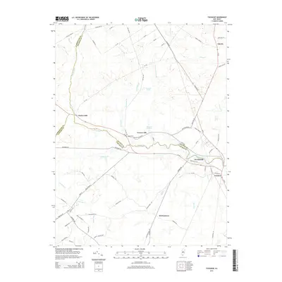
2014 Map of Tuckahoe
USGS Topo · Published 2014About this map
The Tuckahoe River serves as a natural boundary and vital artery in this southern New Jersey landscape, winding through the convergence of Cumberland, Atlantic, and Cape May counties. This modern topographic survey reveals the enduring footprint of historic hamlets and mill sites established along the river's edge, including Marshallville and Tuckahoe. The interior forest and wetlands are drained by numerous named branches and runs, such as Tarkiln Brook and Savages Run, which illustrate the complex hydrology of the Pinelands region. Road networks like RT-49 and RT-50 connect small settlements such as Steelmantown and Oakville, while legacy water features like Warners Mill Pond and Five Acre Pond hint at the area's early industrial history centered on timber and water-powered milling. This record is particularly useful for researchers tracing the evolution of these small South Jersey communities and their relationship with the surrounding tidal and freshwater ecosystems.
Find a feature on this map
72 named features on this map. Tap any name to fly to it.
Don’t see what you’re looking for? This feature index may not catch every label — zoom into the map to look around manually.
Map Details
Editions of this 2014 Tuckahoe Map
This is the sole edition of this map. No revisions or reprints were ever made.
Other maps of this area

1884 · Sea Isle
USGS Topo · 1:62,500

1888 · Dennisville
USGS Topo · 1:62,500

1888 · Sea Isle
USGS Topo · 1:62,500

1890 · Great Egg Harbor
USGS Topo · 1:62,500

1890 · Tuckahoe
USGS Topo · 1:62,500

1893 · Great Egg Harbor
USGS Topo · 1:62,500

1893 · Tuckahoe
USGS Topo · 1:62,500

1894 · Dennisville
USGS Topo · 1:62,500

1894 · Sea Isle
USGS Topo · 1:62,500

1918 · Great Egg Harbor
USGS Topo · 1:62,500