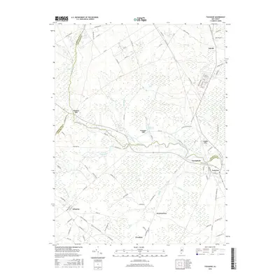
2016 Map of Tuckahoe
USGS Topo · Published 2016About this map
Tuckahoe and Marshallville sit at the confluence of tidal marshes and pine forests where the Tuckahoe River forms the boundary between Atlantic and Cape May counties. This landscape is defined by its historic water-powered industry, evident in the naming of settlements like Hunters Mill and Warners Mill along the northern tributaries. The intricate network of small streams, including Tarkiln Brook and Mill Creek, suggests a long history of land use centered on the region's diverse hydrology and timber resources. To the south, the grid of Woodbine and the crossroads at Belleplain mark the transition toward the interior coastal plain. The presence of Warners Mill Pond and Five Acre Pond highlights the importance of these impoundments to the local topography. This survey provides a clear view of the established residential centers and their relationship to the surrounding wetlands and protected forest areas.
Find a feature on this map
99 named features on this map. Tap any name to fly to it.
Don’t see what you’re looking for? This feature index may not catch every label — zoom into the map to look around manually.
Map Details
Editions of this 2016 Tuckahoe Map
This is the sole edition of this map. No revisions or reprints were ever made.
Other maps of this area

1884 · Sea Isle
USGS Topo · 1:62,500

1888 · Dennisville
USGS Topo · 1:62,500

1888 · Sea Isle
USGS Topo · 1:62,500

1890 · Great Egg Harbor
USGS Topo · 1:62,500

1890 · Tuckahoe
USGS Topo · 1:62,500

1893 · Great Egg Harbor
USGS Topo · 1:62,500

1893 · Tuckahoe
USGS Topo · 1:62,500

1894 · Dennisville
USGS Topo · 1:62,500

1894 · Sea Isle
USGS Topo · 1:62,500

1918 · Great Egg Harbor
USGS Topo · 1:62,500