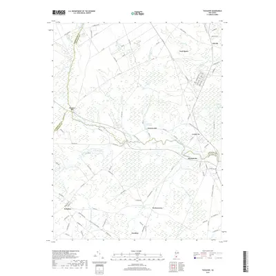
2019 Map of Tuckahoe
USGS Topo · Published 2019About this map
The Tuckahoe River serves as the central artery for this South Jersey landscape, marking the historic convergence of Atlantic, Cape May, and Cumberland counties. The map documents a geography defined by its riparian economy and early industrial sites, including Hunters Mill and Warners Mill, where Warners Mill Pond and Warners Mill Stream indicate a legacy of water-powered operations. The settlement pattern follows the river's winding course, linking established communities like Corbin City and Marshallville to the north and the gridded streets of Woodbine and Belleplain to the south. Significant wetlands and drainages such as Tarkiln Brook, Mill Creek, and Savages Run dominate the low-lying terrain between the towns. Modern infrastructure, including the Atlantic City Electric ROW and various county highways, now traverses the same routes once established by colonial-era mills and river crossings.
Find a feature on this map
93 named features on this map. Tap any name to fly to it.
Don’t see what you’re looking for? This feature index may not catch every label — zoom into the map to look around manually.
Map Details
Editions of this 2019 Tuckahoe Map
This is the sole edition of this map. No revisions or reprints were ever made.
Other maps of this area

1884 · Sea Isle
USGS Topo · 1:62,500

1888 · Dennisville
USGS Topo · 1:62,500

1888 · Sea Isle
USGS Topo · 1:62,500

1890 · Great Egg Harbor
USGS Topo · 1:62,500

1890 · Tuckahoe
USGS Topo · 1:62,500

1893 · Great Egg Harbor
USGS Topo · 1:62,500

1893 · Tuckahoe
USGS Topo · 1:62,500

1894 · Dennisville
USGS Topo · 1:62,500

1894 · Sea Isle
USGS Topo · 1:62,500

1918 · Great Egg Harbor
USGS Topo · 1:62,500