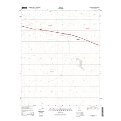
2014 Map of Tucker Mesa SW
USGS Topo · Published 2014About this map
Meteor City and Dennison serve as primary landmarks along the northern corridor of this Coconino County landscape. The area is defined by a sparse settlement pattern that follows the path of Interstate 40 and Highway 180, with Frontage 1-40 W providing local access. The terrain transitions south toward Tucker Mesa, where the land is punctuated by vital water management features such as Beacon Tank, Bull Tank, and Brown Tanks.
Find a feature on this map
15 named features on this map. Tap any name to fly to it.
Don’t see what you’re looking for? This feature index may not catch every label — zoom into the map to look around manually.
Map Details
Editions of this 2014 Tucker Mesa SW Map
This is the sole edition of this map. No revisions or reprints were ever made.
Other maps of this area

1883 · Tusayan
USGS Topo · 1:250,000

1886 · Tusayan
USGS Topo · 1:250,000

1886 · San Francisco Mtns
USGS Topo · 1:250,000

1886 · Holbrook
USGS Topo · 1:250,000

1887 · Verde
USGS Topo · 1:250,000

1891 · San Francisco Mtns
USGS Topo · 1:250,000

1892 · Verde
USGS Topo · 1:250,000

1893 · Holbrook
USGS Topo · 1:250,000

1894 · San Francisco Mtns
USGS Topo · 1:250,000

1899 · San Francisco Mtns
USGS Topo · 1:250,000