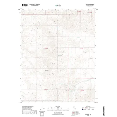
2018 Map of Tucki Wash
USGS Topo · Published 2018About this map
Death Valley National Park encompasses the stark and high-relief terrain of this California landscape, dominated by the prominent elevation of Tucki Mtn. The drainage patterns here are defined by seasonal watercourses like Tucki Wash in the north and the complex branching of the Blackwater Wash system to the south. This southern drainage is composed of the Dry Fork Blackwater Wash and the Wet Fork Blackwater Wash, which converge near the critical water source at Blackwater Spring. Situated at the northern edge of the Mojave Desert, the map illustrates the transition from high mountain slopes down into the basin of Death Valley itself. The absence of roads or permanent structures reflects the extreme nature of this protected environment, where land management is defined by the Public Land Survey System sections and the expansive wilderness of the national park.
Find a feature on this map
16 named features on this map. Tap any name to fly to it.
Don’t see what you’re looking for? This feature index may not catch every label — zoom into the map to look around manually.
Map Details
Editions of this 2018 Tucki Wash Map
This is the sole edition of this map. No revisions or reprints were ever made.
Other maps of this area

1908 · Furnace Creek
USGS Topo · 1:250,000

1908 · Ballarat
USGS Topo · 1:250,000

1910 · Furnace Creek
USGS Topo · 1:250,000

1913 · Ballarat
USGS Topo · 1:250,000

1942 · Bullfrog
USGS Topo · 1:125,000

1948 · Death Valley
USGS Topo · 1:250,000

1952 · Chloride Cliff
USGS Topo · 1:50,000

1952 · Stovepipe Wells
USGS Topo · 1:62,500

1952 · Furnace Creek
USGS Topo · 1:62,500

1952 · Emigrant Canyon
USGS Topo · 1:62,500