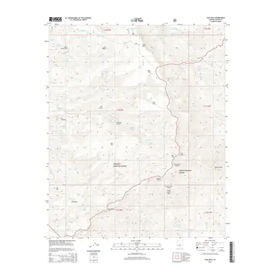
2014 Map of Tule Mesa
USGS Topo · Published 2014About this map
The Verde Rim provides a sharp natural boundary in this 2014 study of the Yavapai County high country, where the Prescott National Forest and Tonto National Forest meet. The landscape is defined by its complex drainage network and elevated flats, including Tule Mesa and Little Mesa. A network of water sources, such as Tule Spring, Chalk Spring, and Nelson Place Spring, indicates a terrain where water management is vital for ranching and forest operations.
Find a feature on this map
83 named features on this map. Tap any name to fly to it.
Don’t see what you’re looking for? This feature index may not catch every label — zoom into the map to look around manually.
Map Details
Editions of this 2014 Tule Mesa Map
This is the sole edition of this map. No revisions or reprints were ever made.
Other maps of this area

1887 · Verde
USGS Topo · 1:250,000

1892 · Verde
USGS Topo · 1:250,000

1929 · Turret Peak
USGS Topo · 1:125,000

1933 · Turret Peak
USGS Topo · 1:125,000

1954 · Holbrook
USGS Topo · 1:250,000

1957 · Holbrook
USGS Topo · 1:250,000

1958 · Holbrook
USGS Topo · 1:250,000

1960 · Holbrook
USGS Topo · 1:250,000
1967 · Brooklyn Peak
USGS Topo · 1:24,000
1967 · Arnold Mesa
USGS Topo · 1:24,000