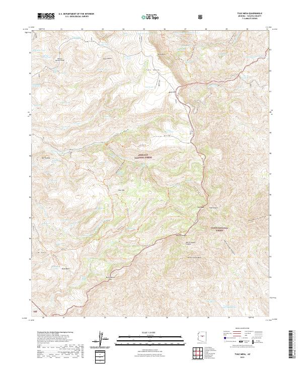
2021 Map of Tule Mesa
USGS Topo · Published 2021About this map
Tule Mesa dominates this high-elevation landscape in Yavapai County, where the high-altitude terrain is managed as part of both the Prescott National Forest and Tonto National Forest. The geography is defined by a series of steep drainages including Beehouse Canyon, Trap Canyon, and Monroe Canyon that cut through the prominent Verde Rim. This 2021 survey shows a land shaped by the necessity of water management in a desert environment, documented through numerous livestock or wildlife tanks such as Tule Canyon Tank, Horse Pasture Tank, and the Little Mesa Tanks.
Find a feature on this map
104 named features on this map. Tap any name to fly to it.
Don’t see what you’re looking for? This feature index may not catch every label — zoom into the map to look around manually.
Map Details
Editions of this 2021 Tule Mesa Map
This is the sole edition of this map. No revisions or reprints were ever made.
Other maps of this area

1887 · Verde
USGS Topo · 1:250,000

1892 · Verde
USGS Topo · 1:250,000

1929 · Turret Peak
USGS Topo · 1:125,000

1933 · Turret Peak
USGS Topo · 1:125,000

1954 · Holbrook
USGS Topo · 1:250,000

1957 · Holbrook
USGS Topo · 1:250,000

1958 · Holbrook
USGS Topo · 1:250,000

1960 · Holbrook
USGS Topo · 1:250,000
1967 · Brooklyn Peak
USGS Topo · 1:24,000
1967 · Arnold Mesa
USGS Topo · 1:24,000