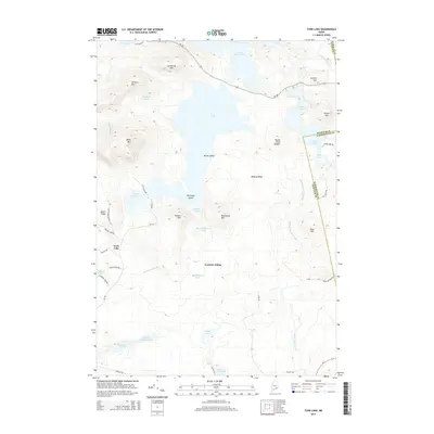
2014 Map of Tunk Lake
USGS Topo · Published 2014About this map
Tunk Lake dominates this Downeast Maine landscape, a deep water body surrounded by a rugged collection of granite peaks including Catherine Mtn, Caribou Mtn, and Black Mtn. The 2014 survey reveals a transition from these high summits down to the low-lying wetlands and coastal bogs of the south. Evidence of the region's rail and timber history appears at Goodwin Siding, while a dense network of smaller waters like Wizard Pond, Spring River Lake, and Flanders Pond are connected by drainages such as Tunk Stream and Whitten Parritt Stream. The map details the remote character of the Hancock and Washington County border, where isolated routes like Me-182 and Black Mountain Rd provide the only access to these glacial ponds and ridges.
Find a feature on this map
56 named features on this map. Tap any name to fly to it.
Don’t see what you’re looking for? This feature index may not catch every label — zoom into the map to look around manually.
Map Details
Editions of this 2014 Tunk Lake Map
This is the sole edition of this map. No revisions or reprints were ever made.
Other maps of this area

1902 · Cherryfield
USGS Topo · 1:62,500

1904 · Cherryfield
USGS Topo · 1:62,500

1904 · Bar Harbor
USGS Topo · 1:62,500

1904 · Petit Manan
USGS Topo · 1:62,500

1930 · Tunk Lake
USGS Topo · 1:48,000

1932 · Tunk Lake
USGS Topo · 1:62,500

1942 · Bar Harbor
USGS Topo · 1:62,500

1942 · Cherryfield
USGS Topo · 1:62,500

1942 · Tunk Lake
USGS Topo · 1:62,500

1948 · Bangor
USGS Topo · 1:250,000