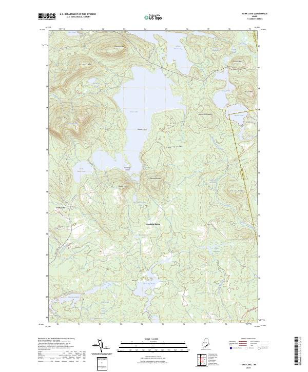
2024 Map of Tunk Lake
USGS Topo · Published 2024About this map
Tunk Lake dominates this coastal Maine interior, surrounded by a dramatic sequence of peaks including Catherine Mtn, Caribou Mtn, and Black Mtn. The landscape is characterized by a complex network of wetlands and smaller water bodies, from the Downing Deadwater in the north to the Goose Pond Heath and Bobs Heath further south. The settlement of Tunk Lake and the former railway stop at Goodwin Siding provide human points of reference in an otherwise dense wilderness of ridges and meadows.
Find a feature on this map
60 named features on this map. Tap any name to fly to it.
Don’t see what you’re looking for? This feature index may not catch every label — zoom into the map to look around manually.
Map Details
Editions of this 2024 Tunk Lake Map
This is the sole edition of this map. No revisions or reprints were ever made.
Other maps of this area

1902 · Cherryfield
USGS Topo · 1:62,500

1904 · Cherryfield
USGS Topo · 1:62,500

1904 · Bar Harbor
USGS Topo · 1:62,500

1904 · Petit Manan
USGS Topo · 1:62,500

1930 · Tunk Lake
USGS Topo · 1:48,000

1932 · Tunk Lake
USGS Topo · 1:62,500

1942 · Bar Harbor
USGS Topo · 1:62,500

1942 · Cherryfield
USGS Topo · 1:62,500

1942 · Tunk Lake
USGS Topo · 1:62,500

1948 · Bangor
USGS Topo · 1:250,000