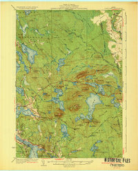
1932 Map of Tunk Lake
USGS Topo · Published 1932About this map
Tunk Mountain and a cluster of high peaks dominate the landscape of this 1930s Maine survey, where the granite geology supported local industry at the Granite Quarries near Sullivan Harbor. The era's rail-dependent economy is evident in the Maine Central line winding along the southern coastal settlements like North Sullivan and East Sullivan. Inland, the map reveals a wilderness transition into recreational and conservation uses, marked by the Partridge Wick-up Club and Big Chief Camps on the shores of Tunk Lake.
Find a feature on this map
129 named features on this map. Tap any name to fly to it.
Don’t see what you’re looking for? This feature index may not catch every label — zoom into the map to look around manually.
Map Details
Editions of this 1932 Tunk Lake Map
4 editions found
Other maps of this area

1902 · Cherryfield
USGS Topo · 1:62,500

1904 · Cherryfield
USGS Topo · 1:62,500

1904 · Mount Desert
USGS Topo · 1:62,500

1904 · Bar Harbor
USGS Topo · 1:62,500

1904 · Petit Manan
USGS Topo · 1:62,500

1911 · Ellsworth
USGS Topo · 1:62,500

1929 · Great Pond
USGS Topo · 1:48,000

1929 · Lead Mountain
USGS Topo · 1:48,000

1930 · Tunk Lake
USGS Topo · 1:48,000

1932 · Tunk Lake
USGS Topo · 1:62,500