2024 Map of Tunnel Hill
USGS Topo · Published 2024About this map
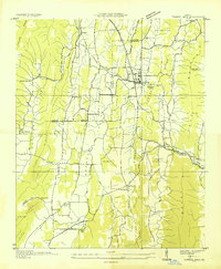
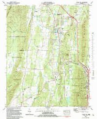
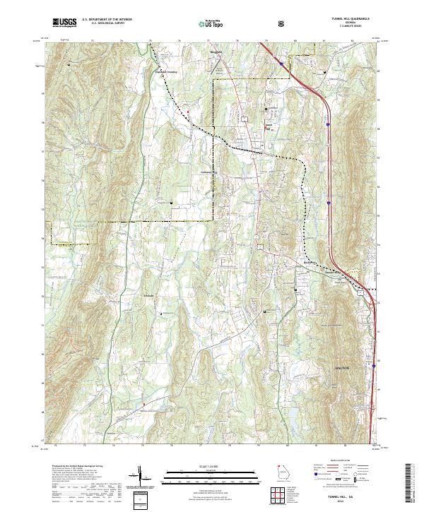
Tunnel Hill occupies a prominent gap in the northern Georgia landscape, situated where the ridge of its namesake meets the Dogwood Valley. This 2024 map documents a corridor defined by the steep North Georgia terrain of Taylor Ridge and Rocky Face Mountain, showcasing how human settlement and infrastructure follow the natural passes. To the south, Dalton extends its reach toward Dalton State College and the McClellan Creek drainage. The map provides significant detail for genealogists, identifying numerous family-named burial grounds like Callaway Cem, Foster Cem, and Dedmon Cem. The northern boundary includes Ringgold and Copeland Crossing, illustrating the continued importance of these historical transit points. Large tracts of the Chattahoochee National Forest dominate the western portion, preserving the wooded character of the ridges above Houston Valley.
Find a feature on this map
169 named features on this map. Tap any name to fly to it.
Don’t see what you’re looking for? This feature index may not catch every label — zoom into the map to look around manually.
Map Details
Editions of this 2024 Tunnel Hill Map
This is the sole edition of this map. No revisions or reprints were ever made.
Historical Maps of Hassler Mill Through Time
4 maps found