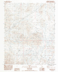
1983 Map of Turquoise Mtn
USGS Topo · Published 1984About this map
Turquoise Mountain dominates this desert landscape in San Bernardino County, where mining activity and remote infrastructure define the terrain during the early 1980s. The map reveals a history of resource extraction, noting the Yucca Mine and Wander Mine alongside several Open Pit Mine and Borrow Pit sites. These workings are connected by a network of 4wd trails and service roads that navigate the arid slopes between the Silurian Hills and the central peaks.
Find a feature on this map
21 named features on this map. Tap any name to fly to it.
Don’t see what you’re looking for? This feature index may not catch every label — zoom into the map to look around manually.
Map Details
Editions of this 1983 Turquoise Mtn Map
2 editions found
Other maps of this area

1910 · Ivanpah
USGS Topo · 1:250,000

1912 · Ivanpah
USGS Topo · 1:250,000

1933 · Avawatz Mountains
USGS Topo · 1:250,000

1942 · Ivanpah
USGS Topo · 1:250,000

1947 · Trona
USGS Topo · 1:250,000

1947 · Kingman
USGS Topo · 1:250,000

1948 · Kingman
USGS Topo · 1:250,000

1948 · Trona
USGS Topo · 1:250,000

1953 · Trona
USGS Topo · 1:250,000

1954 · Kingman
USGS Topo · 1:250,000