Loading...
Loading map...2022 Map of Turtle Lake
USGS Topo · Published 2022About this map
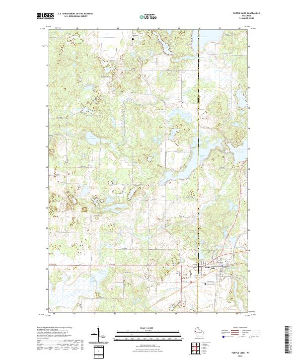
The village of Turtle Lake serves as a central hub in this modern survey, marking the intersection of regional road networks and the Cattail State Trl. This landscape, straddling the border of Polk and Barron counties, is defined by an intricate system of glacial kettle lakes and wetlands. Local history and genealogy are anchored by several established burial grounds, including Mount Hope Cem and Saint Ann Cem near the town site, and the Christ Lutheran Cem further north.
Find a feature on this map
63 named features on this map. Tap any name to fly to it.
Don’t see what you’re looking for? This feature index may not catch every label — zoom into the map to look around manually.
Map Details
Date Portrayed2022
Date Published2022
PublisherU.S. Geological Survey
Map TypeTopographic
Scale1:24000
Physical Dimensions24 x 29 inches
Editions of this 2022 Turtle Lake Map
This is the sole edition of this map. No revisions or reprints were ever made.
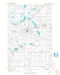
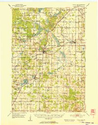
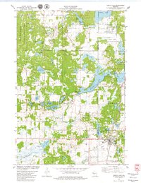
Historical Maps of Turtle Lake Through Time
4 maps found
Featured Locations
Source Details
SourceU.S. Geological Survey
CopyrightPublic Domain