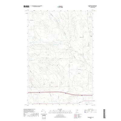
2018 Map of Twin Brook
USGS Topo · Published 2018About this map
Littleton Ridge anchors the eastern side of this Aroostook County landscape, where the terrain is defined by a dense network of waterways including Twin Brook and the lengthy Captain Ambrose Bear Stream. The drainage patterns here are complex, with small lakes like Bradbury Lake and numerous brooks such as Moose Brook and Dog Brook carving through the countryside. This area is crisscrossed by local routes named for area families and early residents, including Estabrook Rd, Mansur Brook Rd, and McLaughlin Rd. For those researching local history or genealogy, the Ludlow Cem near Ludlow Rd provides a central point of interest in a region primarily shaped by its hydrology and traditional rural road networks. The map details the transition between wooded creek beds and the slightly higher elevations of the ridges that overlook the brooks.
Find a feature on this map
48 named features on this map. Tap any name to fly to it.
Don’t see what you’re looking for? This feature index may not catch every label — zoom into the map to look around manually.
Map Details
Editions of this 2018 Twin Brook Map
This is the sole edition of this map. No revisions or reprints were ever made.
Other maps of this area

1934 · Bridgewater
USGS Topo · 1:48,000

1935 · Howe Brook
USGS Topo · 1:48,000

1937 · Smyrna Mills
USGS Topo · 1:62,500

1938 · Bridgewater
USGS Topo · 1:62,500

1938 · Houlton
USGS Topo · 1:62,500

1939 · Howe Brook
USGS Topo · 1:62,500

1951 · Houlton
USGS Topo · 1:62,500

1951 · Bridgewater
USGS Topo · 1:62,500

1953 · Bridgewater
USGS Topo · 1:50,000

1954 · Howe Brook
USGS Topo · 1:62,500