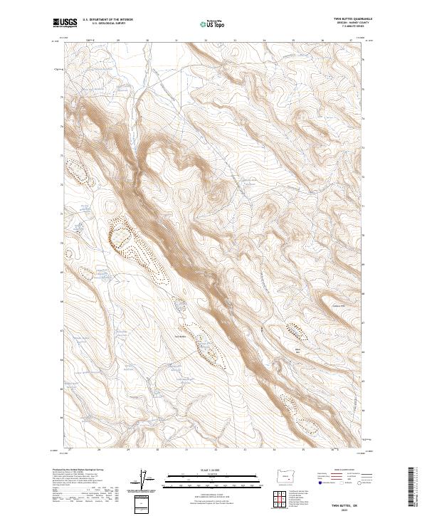
2023 Map of Twin Buttes
USGS Topo · Published 2023About this map
Twin Buttes rises above a landscape defined by an extensive network of water management features in this high desert region of Harney County. The distribution of reservoirs and waterholes suggests a landscape heavily adapted for livestock and rangeland use, with named sites such as Mammoth Waterhole, Tooney Waterhole, and Griffen Waterhole scattered across the basin. Large-scale topographic features like Jackass Mtn and the prominent Black Rim provide significant vertical relief against the surrounding flats.
Find a feature on this map
37 named features on this map. Tap any name to fly to it.
Don’t see what you’re looking for? This feature index may not catch every label — zoom into the map to look around manually.
Map Details
Editions of this 2023 Twin Buttes Map
This is the sole edition of this map. No revisions or reprints were ever made.
Other maps of this area

1955 · Burns
USGS Topo · 1:250,000

1955 · Adel
USGS Topo · 1:250,000

1957 · Adel
USGS Topo · 1:250,000

1958 · Burns
USGS Topo · 1:250,000

1958 · Adel
USGS Topo · 1:250,000

1959 · Burns
USGS Topo · 1:250,000

1962 · Adel
USGS Topo · 1:250,000

1967 · Coyote Buttes
USGS Topo · 1:24,000

1967 · Jackass Butte
USGS Topo · 1:24,000
1967 · Irish Lake
USGS Topo · 1:24,000