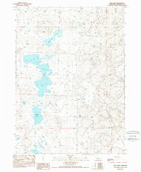
1989 Map of Twin Lakes
USGS Topo · Published 1989About this map
Twin Lakes and a complex network of smaller basins dominate this Sheridan County landscape, reflecting the unique hydrology of the Nebraska Sandhills. The water system includes Cravath Lake to the north and several smaller bodies such as Albrecht Lake, Diamond Lake, and Goose Lake further south. These lakes are connected by ephemeral drainage patterns, with Pine Creek cutting through the northern sections of the terrain.
Find a feature on this map
13 named features on this map. Tap any name to fly to it.
Don’t see what you’re looking for? This feature index may not catch every label — zoom into the map to look around manually.
Map Details
Editions of this 1989 Twin Lakes Map
This is the sole edition of this map. No revisions or reprints were ever made.
Other maps of this area

1948 · Antioch
USGS Topo · 1:62,500

1948 · Lakeside
USGS Topo · 1:62,500

1948 · Twin Lakes
USGS Topo · 1:62,500

1949 · Antioch
USGS Topo · 1:62,500

1950 · Twin Lakes
USGS Topo · 1:62,500

1950 · Lakeside
USGS Topo · 1:62,500

1950 · Skunk Lake
USGS Topo · 1:62,500

1955 · Alliance
USGS Topo · 1:250,000

1957 · Alliance
USGS Topo · 1:250,000

1958 · Alliance
USGS Topo · 1:250,000