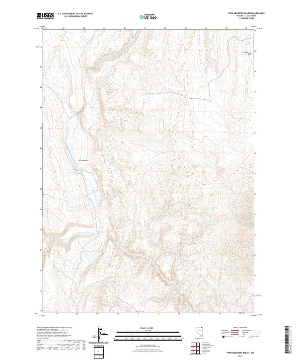
2021 Map of Twin Meadows Ranch
USGS Topo · Published 2021About this map
Twin Meadows sits at the heart of this high-desert landscape in Elko County, where the hydrology of the Great Basin is on full display. The area is defined by the complex drainage system of the Salmon Falls Cr, including the confluence of the N Fork Salmon Falls Cr and S Fork Salmon Falls Cr. These waterways, along with tributaries like Willow Cr and Scott Cr, carve through the basin and range topography, illustrating the vital role of seasonal water in this arid ranching country. To the northeast, the expanse of Cottonwood Field suggests a localized area of flatter terrain or historical land use amidst the surrounding drainage breaks. This 2021 update reflects the modern Bureau of Land Management boundaries and hydrography of a region where the natural water network continues to dictate the footprint of human activity and cattle ranching.
Find a feature on this map
13 named features on this map. Tap any name to fly to it.
Don’t see what you’re looking for? This feature index may not catch every label — zoom into the map to look around manually.
Map Details
Editions of this 2021 Twin Meadows Ranch Map
This is the sole edition of this map. No revisions or reprints were ever made.
Other maps of this area

1955 · Wells
USGS Topo · 1:250,000

1957 · Contact
USGS Topo · 1:62,500

1957 · Elk Mountain
USGS Topo · 1:62,500

1958 · Wells
USGS Topo · 1:250,000

1961 · Wells
USGS Topo · 1:250,000

1968 · Hubbard Basin
USGS Topo · 1:24,000

1968 · Henry
USGS Topo · 1:24,000
1968 · Gilmer Ranch
USGS Topo · 1:24,000
1981 · Jarbidge Mts
USGS Topo · 1:100,000

1982 · Jackpot
USGS Topo · 1:100,000