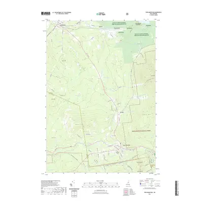
2021 Map of Twin Mountain
USGS Topo · Published 2021About this map
Twin Mountain and the surrounding high country of Coos County are documented here in a 2021 landscape shaped by both aviation and conservation. The northern reaches include the Silvio O Conte National Fish and Wildlife Refuge and the Mount Washington Regional Airport, while the southern half is dominated by the White Mountain National Forest. High peaks like Cherry Mtn and Mt Martha tower over a complex drainage system where the Ammonoosuc River and Little River converge. Settlement patterns are concentrated along the valley floors near Carroll and Whitefield, with the historic Waumbeck Junction and Hazens marking points of long-standing transport significance. Numerous smaller waterways, such as Carroll Stream and Bear Brook, carve through the terrain, illustrating the dense network of tributaries that feed the region's larger river systems.
Find a feature on this map
89 named features on this map. Tap any name to fly to it.
Don’t see what you’re looking for? This feature index may not catch every label — zoom into the map to look around manually.
Map Details
Editions of this 2021 Twin Mountain Map
This is the sole edition of this map. No revisions or reprints were ever made.
Other maps of this area

1893 · Mt. Washington
USGS Topo · 1:62,500

1895 · Crawford Notch
USGS Topo · 1:62,500

1896 · Mt. Washington
USGS Topo · 1:62,500

1896 · Crawford Notch
USGS Topo · 1:62,500

1900 · Whitefield
USGS Topo · 1:62,500

1929 · Franconia
USGS Topo · 1:62,500

1932 · Franconia
USGS Topo · 1:62,500

1935 · Whitefield
USGS Topo · 1:48,000

1935 · Mt. Washington
USGS Topo · 1:62,500
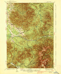
1938 · Mt. Washington
USGS Topo · 1:62,500