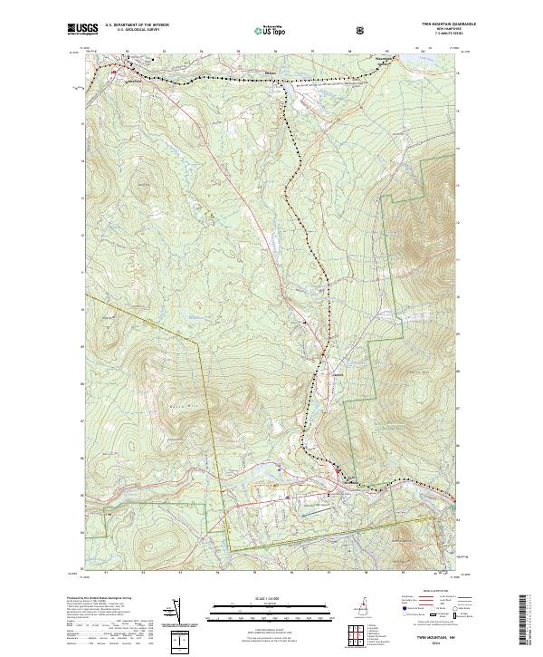
2024 Map of Twin Mountain
USGS Topo · Published 2024About this map
Whitefield and the valley of the Johns River anchor the northern portion of this landscape, where the Silvio O Conte National Fish and Wildlife Refuge now preserves the riparian environment around Airport Marsh Reservoir. The area's transit history is visible in the corridor through Waumbeck Junction and the presence of an Inactive RR Trl, reflecting the era when rail transport was central to the logging and tourism economy of the White Mountains.
Find a feature on this map
79 named features on this map. Tap any name to fly to it.
Don’t see what you’re looking for? This feature index may not catch every label — zoom into the map to look around manually.
Map Details
Editions of this 2024 Twin Mountain Map
This is the sole edition of this map. No revisions or reprints were ever made.
Other maps of this area

1893 · Mt. Washington
USGS Topo · 1:62,500

1895 · Crawford Notch
USGS Topo · 1:62,500

1896 · Mt. Washington
USGS Topo · 1:62,500

1896 · Crawford Notch
USGS Topo · 1:62,500

1900 · Whitefield
USGS Topo · 1:62,500

1929 · Franconia
USGS Topo · 1:62,500

1932 · Franconia
USGS Topo · 1:62,500

1935 · Whitefield
USGS Topo · 1:48,000

1935 · Mt. Washington
USGS Topo · 1:62,500
1938 · Mt. Washington
USGS Topo · 1:62,500