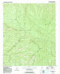
1992 Map of Twin Sisters
USGS Topo · Published 1992About this map
The Continental Divide snake-runs through this high-elevation section of the Gila National Forest, defining the watershed of the Pinos Altos Range. This landscape is marked by the remnants of 19th-century resource extraction, notably an Arrastre for ore processing near several mining Prospects in the southwest corner. The rugged peaks of the Tadpole Pinos Altos Range, including Signal Peak and Black Peak, dominate the central topography. Recreational and commemorative sites are established throughout the forest, including McMillan Campground, Pine Flats Campground, and the Ben Lilly Memorial. Water is sparse but vital, flowing through drainages like Bear Creek, Trout Creek, and the namesake Twin Sisters Creek, while old transportation routes like the Sawmill Wagon Road hint at the area's timber and freight history.
Find a feature on this map
39 named features on this map. Tap any name to fly to it.
Don’t see what you’re looking for? This feature index may not catch every label — zoom into the map to look around manually.
Map Details
Editions of this 1992 Twin Sisters Map
This is the sole edition of this map. No revisions or reprints were ever made.
Other maps of this area

1909 · Silver City
USGS Topo · 1:125,000

1911 · Alum Mountain
USGS Topo · 1:125,000

1913 · Alum Mountain
USGS Topo · 1:125,000

1937 · Santa Rita
USGS Topo · 1:24,000

1947 · Allie Canyon
USGS Topo · 1:24,000

1947 · Twin Sisters
USGS Topo · 1:24,000

1947 · Fort Bayard
USGS Topo · 1:24,000

1948 · Twin Sisters
USGS Topo · 1:24,000

1948 · Santa Rita
USGS Topo · 1:24,000

1948 · Allie Canyon
USGS Topo · 1:24,000